Securing Your Property
with Digital Land
Protection.
A complete digital platform to monitor, verify, and physically secure your property - so you never have to worry about encroachment or fraud again.
Enquire Us Now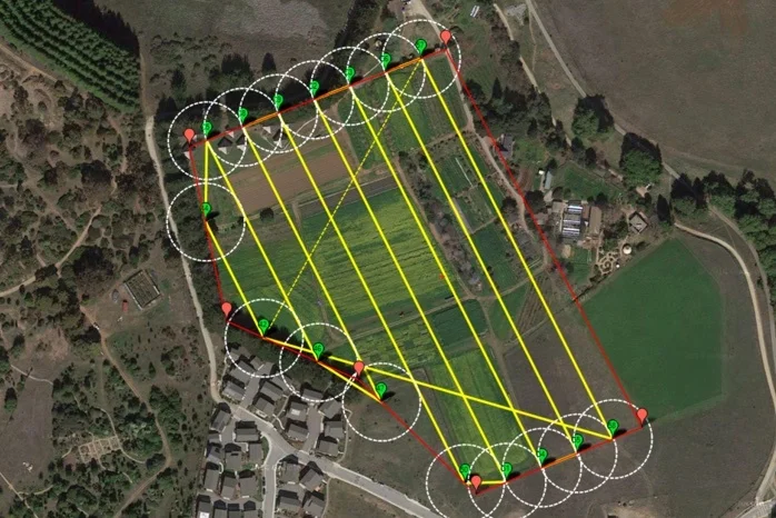
4 Ways We Protect Your Land
From satellite to on-ground — every angle is covered.
Satellite Monitoring
We watch your land from above using satellite images and GIS coordinates. Any boundary change gets flagged immediately.
Monthly Visit & Report
Our officer visits your land every month, takes photos and videos, and sends you a full report. You'll know exactly what's happening.
Fencing & Compound Wall
We clean the site and build a proper boundary — fencing or compound wall — so your land is clearly marked and secured.
Survey & Patta Service
We do DGPS precision surveys, verify your title deed, and handle Patta paperwork with the government on your behalf.
How It Works
Three steps. That's all it takes to protect your land.
You Enquire
Call us or fill the form below. Tell us where your land is. We'll understand your situation and suggest the right protection plan.
We Survey & Setup
Our team visits, does a DGPS survey, verifies your documents, installs fencing if needed, and sets up satellite monitoring.
You Relax
Sit back. Every month you get a report. Any problem — we handle it. Your land is safe. You don't need to visit or worry.
Request a Free Land Audit
Tell us about your land. Our team will call you within 24 hours and explain exactly how we can protect it — for free, no commitment.